1.5.1 UTMSYS3 Integrated UAV Ground-Air Management Platform
Product Description
The UTMSYS3 Integrated UAV Ground-Air Management Platform is an intelligent ground-air coordinated management system integrating equipment management and control, route planning, autonomous operations, video surveillance, intelligent analysis, data archiving, and system operation and maintenance. It connects the data chain of UAVs, autonomous docks, and cloud management.
The platform supports multi-device online coordinated management and control, visualizes inspection route planning and reuse, achieves UAV fully automatic takeoff and landing, autonomous cruise, breakpoint continuation, and remote real-time control. It integrates multi-source video real-time return, screen preview and video playback functions, equipped with AI intelligent recognition algorithms, which can automatically analyze operation screens, count target data, and identify abnormal hazards. At the same time, it can automatically retain flight trajectories, aerial images, and other operation data, generate standardized inspection reports with one click, and match with hierarchical permission management and log traceability functions to achieve intelligent closed-loop management of the entire process of UAV flight operation planning, execution, monitoring, analysis, and archiving. Widely adaptable to various operation scenarios such as security inspection, park operation and maintenance, road monitoring, and emergency investigation.
Software Interface
Login Interface
Flight Interface
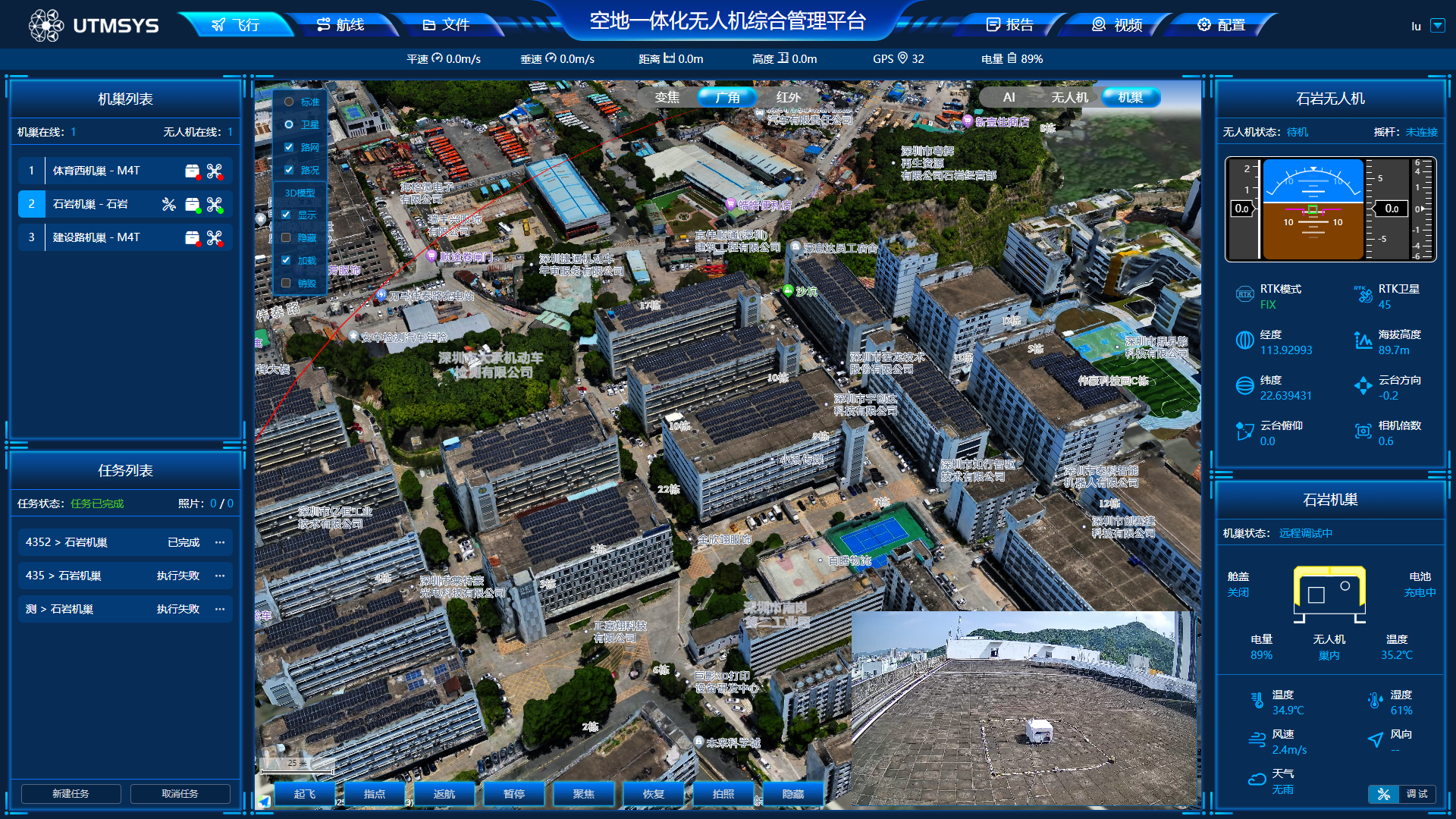
The flight interface is the core control interface for UAV field operations, mainly used for real-time status monitoring and flight task real-time control of UAVs and autonomous docks.
The interface integrates operational awareness, video screen, device parameters, and quick operation functions. It can real-time view UAV position, flight trajectory, flight speed, altitude, battery, signal, and RTK positioning status, while displaying nest working conditions, environmental temperature and humidity, and meteorological data.
Operators can complete task start/stop, pause, resume, waypoint navigation, Return-to-Home (RTH), photo/video and other operations, achieving visual monitoring and emergency intervention throughout the entire operation process, ensuring flight operation safety and controllability.
Route Interface
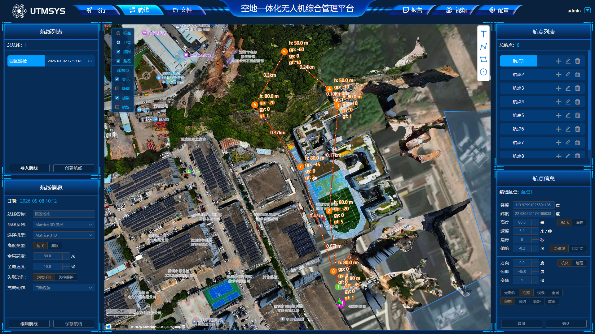
The route interface is mainly used for planning, editing, and managing UAV inspection routes, and is the basic configuration interface for normalized automatic inspection.
It supports independently creating routes, customizing flight altitude, flight speed, hovering duration, and other global parameters. Users can visually add, move, and delete waypoints on the map, and separately configure each waypoint's gimbal angle, zoom factor, photo/video, and other operation actions. All planned routes can be saved, copied, modified, and deleted, supporting repeated calls to execute fixed-area inspection tasks, effectively improving the standardization and efficiency of batch operations.
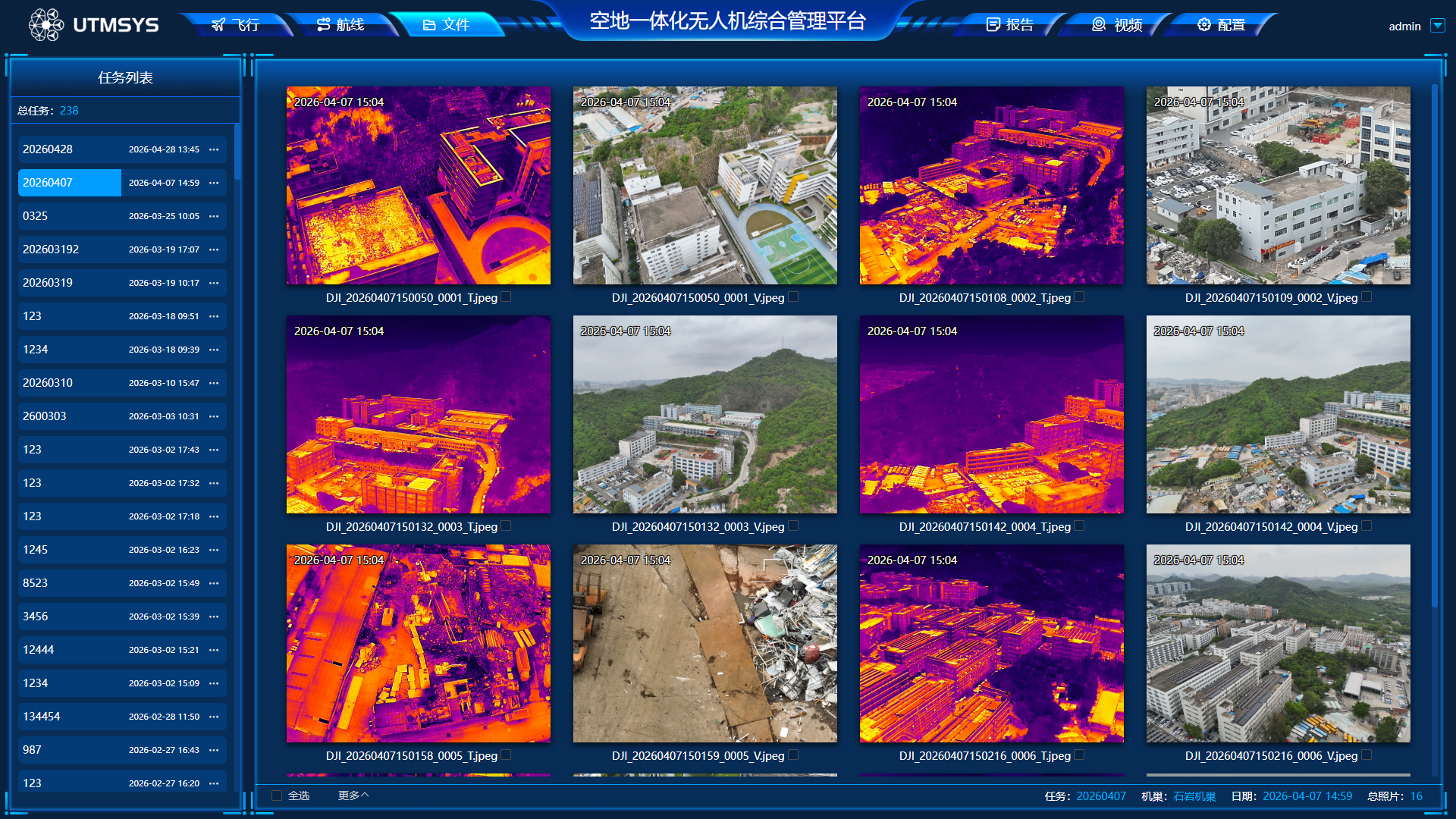
File Interface
The file interface is the centralized archiving and management center for platform operation data, uniformly storing all image materials generated by UAV flight tasks.
The interface classifies and summarizes all aerial photos, ordinary videos, and infrared image data by task and time, supporting thumbnail preview, image switching, file download, and traceability query. At the same time, it can view the shooting time, latitude and longitude, flight altitude, and other metadata corresponding to each data item, achieving operation results that are queryable, viewable, storable, and traceable.
Report Interface
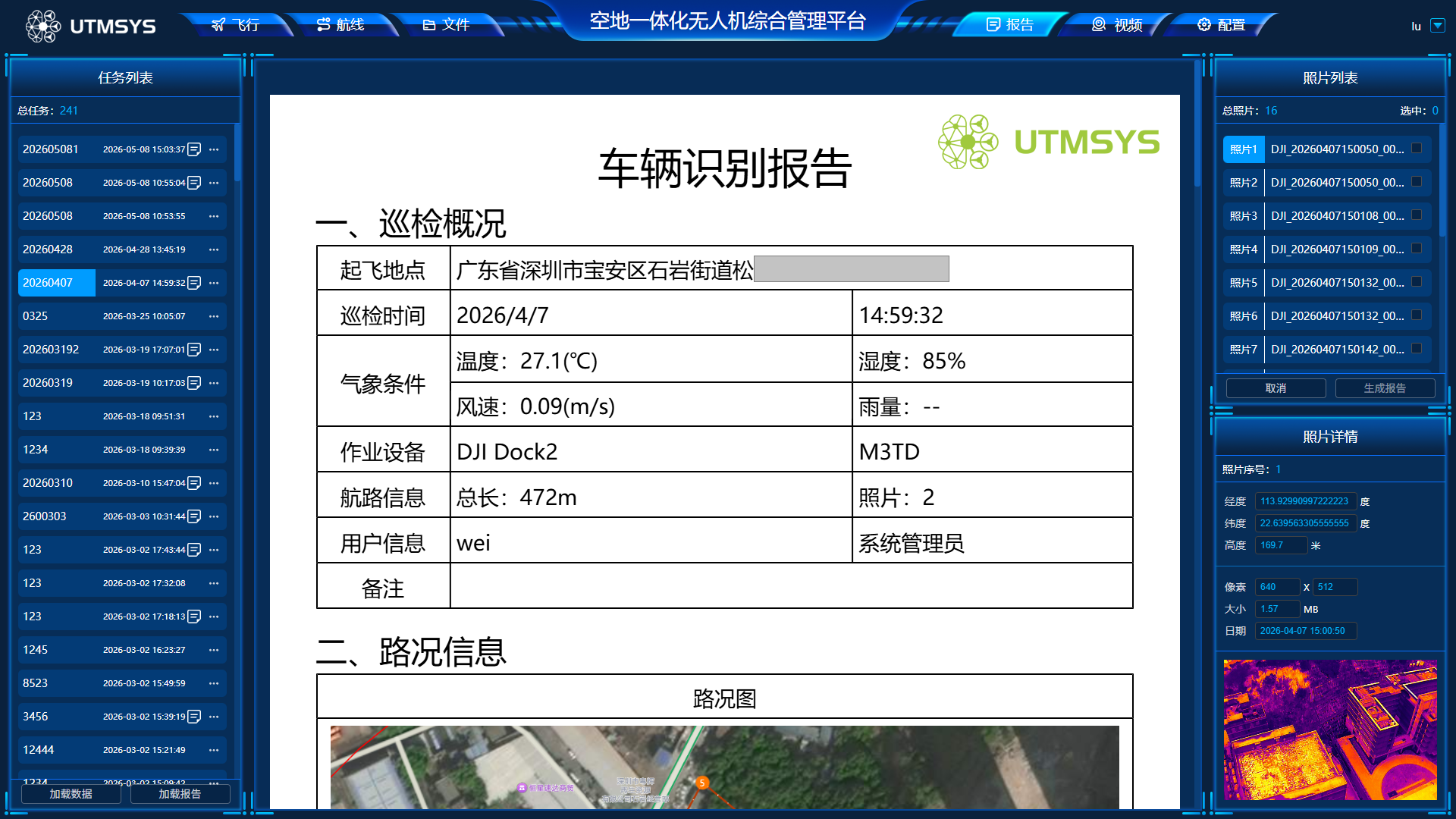
The report interface is used for automatically generating, previewing, and exporting standardized UAV inspection operation reports.
The system can automatically capture flight information, operation trajectory, environmental parameters, device information, AI intelligent recognition statistics results, and on-site image materials from each task, and automatically integrate to generate complete inspection reports. It supports one-click PDF format file generation without manual data sorting, directly usable for work reports, project archiving, hazard statistics, and operation review.
Video Interface
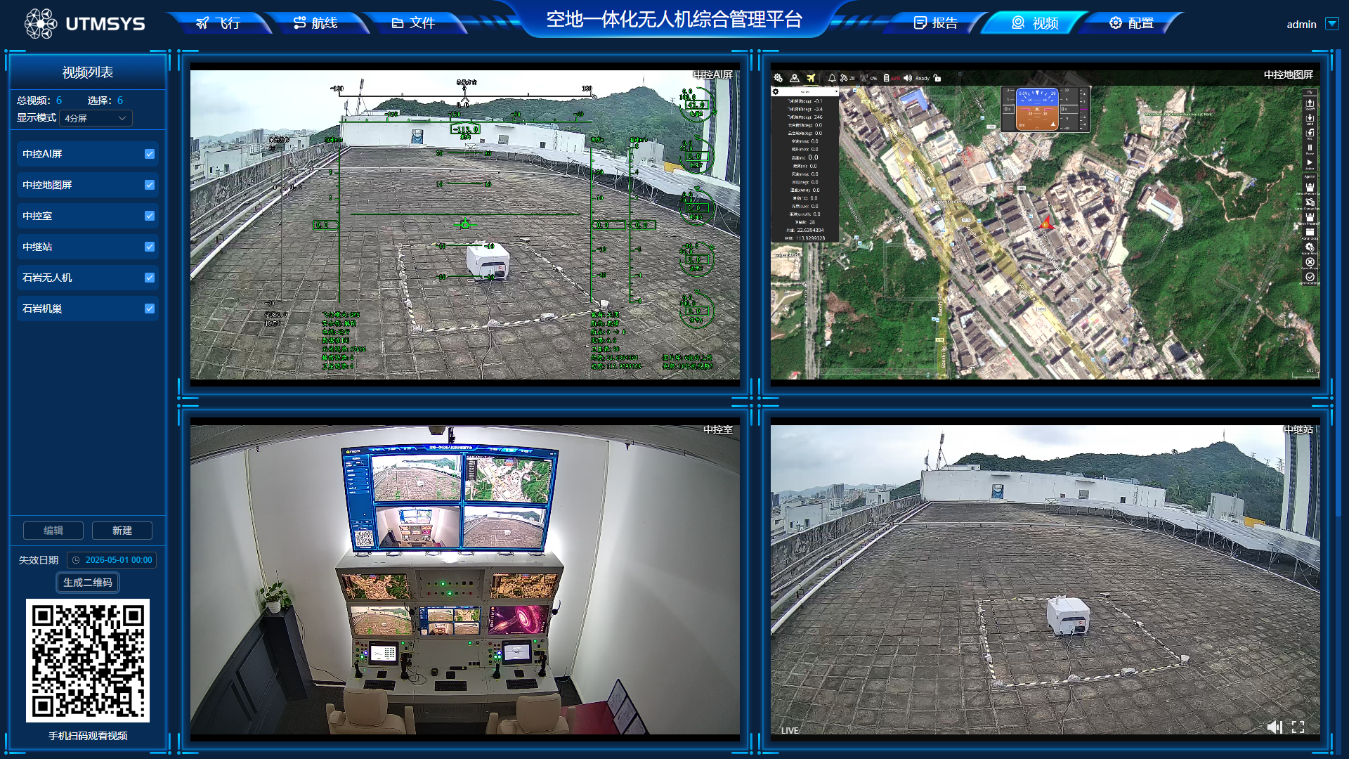
The video interface is a multi-source video centralized monitoring interface, gathering UAV, dock, console, relay station, and other multi-channel video signals to achieve domain-wide video visual management.
It supports single-screen and quad-split multi-screen switching playback, real-time return of UAV wide-angle, zoom, and infrared HD images, with functions such as video real-time recording, historical video playback, screen information overlay, and remote QR code viewing. It can meet scenario requirements such as remote duty, real-time inspection, emergency monitoring, and operation review.
Configuration Interface
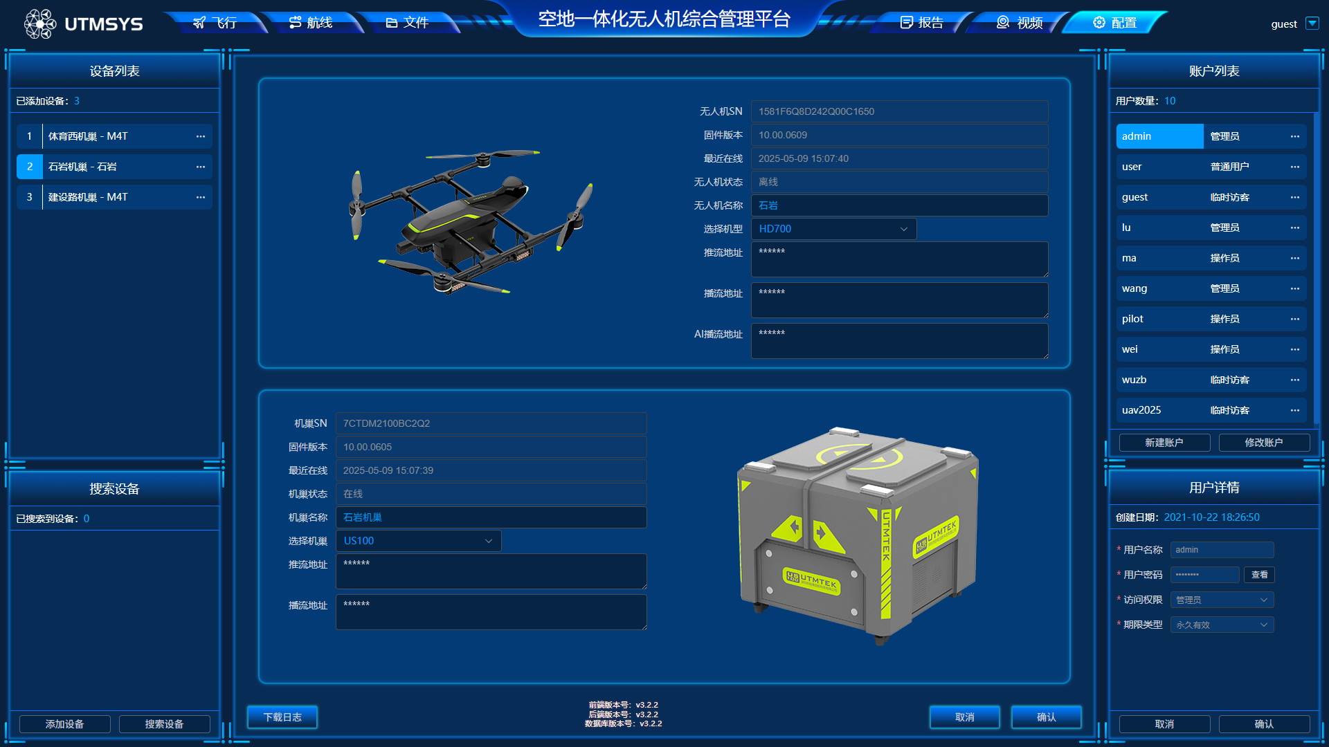
The configuration interface is the core of system backend operation and maintenance management, mainly for managers, responsible for overall platform parameter configuration and permission control.
It includes three core functions: device management, user management, and log management. It can complete hardware device access configuration, status viewing, and parameter debugging for UAVs, docks, and other equipment. It supports adding, editing, and deleting system accounts, hierarchically configuring administrator, operator, visitor, and other role permissions. At the same time, it automatically records system operation logs and device operation logs, supporting log query and export.
Functional Features
| Function | Description |
|---|---|
| Multi-device Coordination | Supports multiple UAVs and docks online simultaneously |
| Route Planning | Visual route editing, supporting altitude, speed, hover and other parameter configuration |
| Autonomous Operations | Fully automatic takeoff/landing, autonomous cruise, mission resume |
| Video Surveillance | Multi-source video real-time return, preview and video playback |
| AI Intelligent Recognition | Automatically analyzes operation screens, counts target data, identifies abnormal hazards |
| Data Archiving | Automatically retains flight trajectories and aerial images, one-click report generation |
| Permission Management | Hierarchical permission control, log traceability |
| System Operation and Maintenance | Device management, status monitoring, parameter debugging |